
Experts in design of sports, play & leisure equipment throughout the UK
Maps & compasses
Educational and fun, bring the classroom outside!
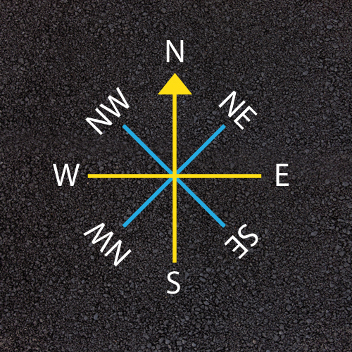
PM-5000 - LINE COMPASS
-
Size: 3m x 3m
-
Description: Basic playground compass using lines pointing to North. A great teaching aid for geography.
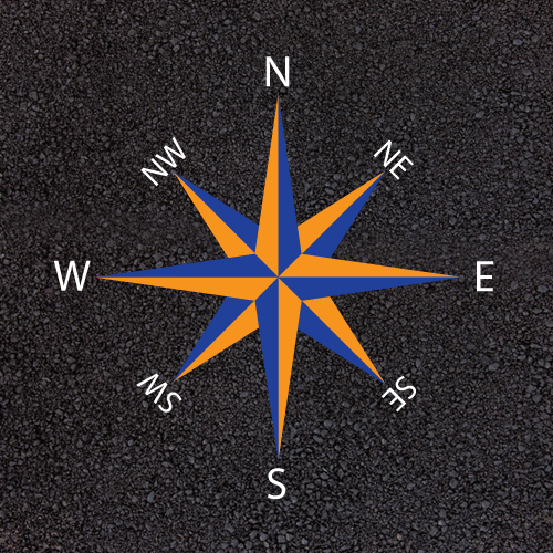
PM-5001 - ROSE COMPASS
-
Size: 3m x 3m
-
Description: Three dimensional compass showing 8 points. At first4playgrounds we install all our playground compasses to point North. A great science teaching aid for teachers and children of all ages.
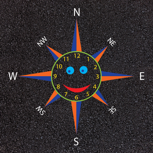
PM-5002 - SMILEY FACE COMPASS
-
Size: 3m x 3m
-
Description: Clock face with smiley face and compass points. Great for teaching nursery and primary school children telling the time and the points of the compass. All compasses point north.
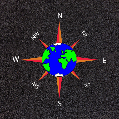
PM-5003 - WORLD COMPASS
-
Size: 3m x 3m
-
Description: World Compass with compass directions . All compasses installed facing the correct direction.
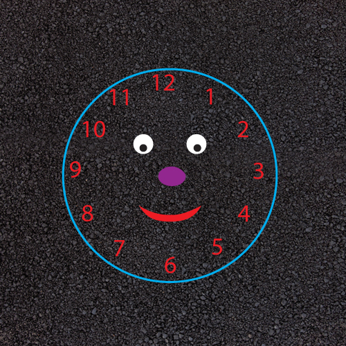
PM-5004 - SMILEY FACE CLOCK
-
Size: 4m x 4m
-
Description: A fun and exciting teaching aid for children to learn to tell the time. A playground marking clock with a smiley face.
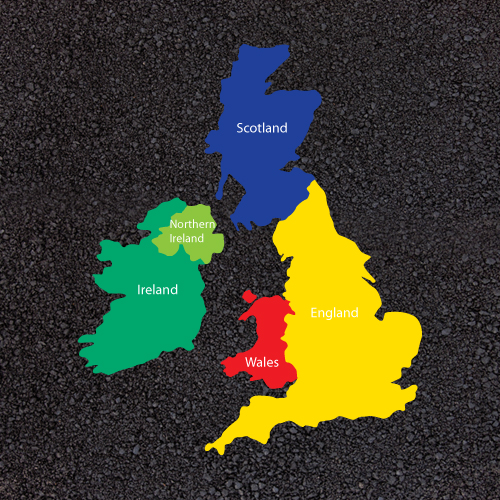
PM-5005 - UK MAP
-
Size: 5m x 4m
-
Description: Large map of the United Kingdom showing England, Scotland, Wales and Ireland in different colours. A great teaching aid for children to learn geography. Some schools have asked for thie town, city or village to be marked on the map to show exactly where they live.
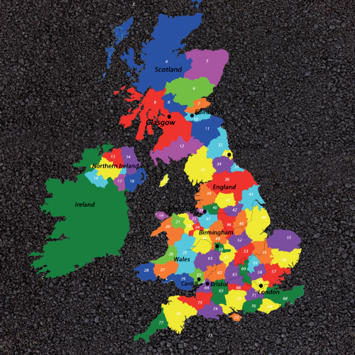
PM-5006 - KEY STAGE 2 UK COUNTIES MAP
-
Size: 5m x 4m
-
Description: Included in the installation price is 10 free laminated copies of the key to all the numbered counties. The map also shows the major capital cities and 5 longest rivers of the UK. We can also identify and name on the map your local town, city or village.
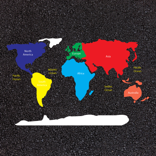
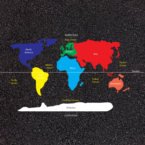
PM-5007 - WORLD MAP CONTINENTS
-
Size: 5m x 4m
-
Description: Playground Map of the World showing all the continents in different colours and the names of all the main oceans. Ideal for children to learn and understand the different continents around the world.
PM-5008 - KEY STAGE 1 WORLD MAP
-
Size: 5m x 4m
-
Description: Due to recent changes in the primary school teaching of geography we have introduced a range of Key Stage Maps. The KS1 map is an ideal learning aid allowing children to familiarise the world map with the names of the continents, oceans, north and south poles as well as the equator.
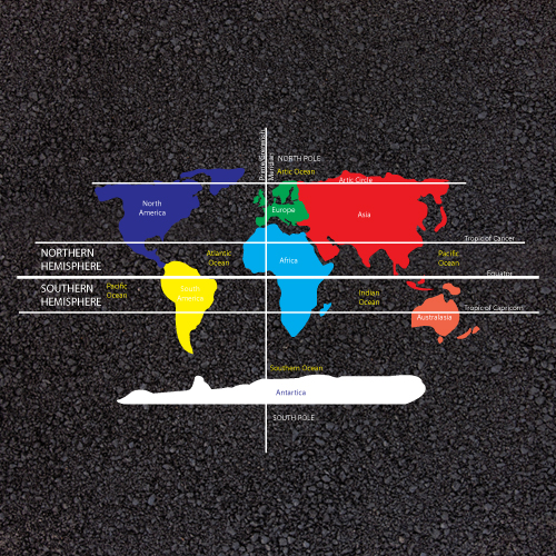
PM-5009 - KEY STAGE 2 WORLD MAP
-
Size: 5m x 4m
-
Description: The map includes the named continents in different colours, the five oceans; the Pacific Ocean, Atlantic Ocean, Indian Ocean, Southern Ocean and the Artic ocean. The map also shows the lines of the equator, the tropics of Cancer and Capricorn and the Greenwick Meridian Line as well as the Northern and Southern Hemispheres.
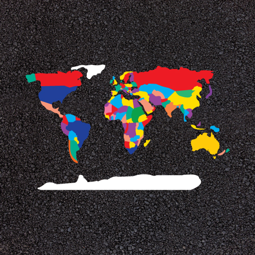
PM-5010 - WORLD MAP
-
Size: 5m x 4m
-
Description: Playground Map of the world showing all the countries in different colours. Ideal for children to learn and understand the different countries around the world.
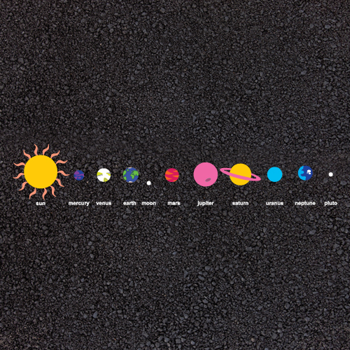
PM-5011 - SOLAR SYSTEM
-
Size: 10m x 1.5m
-
Description: Solar System playground markings are an ideal way to introduce young children into the world of science. The markings include the sun, mercury, venus, earth, the moon, mars, jupiter, saturn, uranus and pluto.
